Property Record
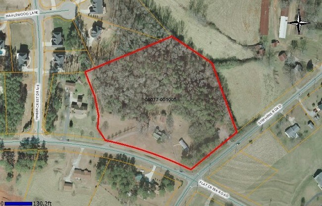
5096 Stephens Rd, Gainesville, GA 30504


NEARBY LISTINGS FOR SALE OR LEASE
Property Detail
5096 Stephens Rd
Gainesville, GA
Oakwood Flat Creek
08-00077-01-005
Hall
Ruralagriculturalresidence
Georgia
X
6.35 AC
13139C0281G
Gainesville/Hall County
6,978 SF
Atlanta
DEMOGRAPHICS near 5096 Stephens Rd
1 Mile
3 Mile
5 Mile
2024 Total Population
4,448
26,450
67,777
2029 Population
5,066
29,880
76,121
Pop Growth 2024-2029
+ 13.89%
+ 12.97%
+ 12.31%
Average Age
41
40
38
2024 Total Households
1,585
9,825
23,990
HH Growth 2024-2029
+ 13.88%
+ 12.90%
+ 12.36%
Median Household Inc
$78,581
$67,807
$67,280
Avg Household Size
2.70
2.60
2.80
2024 Avg HH Vehicles
2.00
2.00
2.00
Median Home Value
$266,165
$267,263
$279,497
Median Year Built
1992
1997
1997
Nearby Places
Map Layers
Map Styles
 Street
 Aerial
- Restaurants
- Banks
- Shops
- Fitness
- Groceries
PUBLIC TRANSPORTATION
COMMUTER RAIL
Gainesville Amtrak Station (Crescent - Amtrak)
DRIVE
WALK
Distance
Gainesville Amtrak Station (Crescent - Amtrak)
15 min
8.1 mi
Freight Ports
Georgia Ports - Savannah
DRIVE
WALK
Distance
Georgia Ports - Savannah
327 min
257.0 mi
SALE & LEASE HISTORY
LISTING DATE
SALE/LEASE

Sep 19, 2017
For Sale
Sep 05, 2017
For Sale
Oct 04, 2017
For Sale
Oct 02, 2017
For Sale
Nearby Properties
Address
Land Use
TOTAL SIZE
Lot Size
Zoning
Address
Land Use
TOTAL SIZE
Lot Size
Zoning
4,624 SF
18,092.04 AC
LR
Address
Land Use
TOTAL SIZE
Lot Size
Zoning
150,738 SF
43.34 AC
M-1
Address
Land Use
TOTAL SIZE
Lot Size
Zoning
92,448 SF
24.25 AC
PUD
Address
Land Use
TOTAL SIZE
Lot Size
Zoning
45,900 SF
6.99 AC
PRD
Address
Land Use
TOTAL SIZE
Lot Size
Zoning
342,720 SF
22.95 AC
PUD
Address
Land Use
TOTAL SIZE
Lot Size
Zoning
174,720 SF
50.23 AC
M-2
Address
Land Use
TOTAL SIZE
Lot Size
Zoning
351,550 SF
26.91 AC
M-2
Address
Land Use
TOTAL SIZE
Lot Size
Zoning
175,622 SF
20.22 AC
M-2
Address
Land Use
TOTAL SIZE
Lot Size
Zoning
304,844 SF
37.58 AC
M-2
Address
Land Use
TOTAL SIZE
Lot Size
Zoning
1,580 SF
15.85 AC
PUD
Address
Land Use
TOTAL SIZE
Lot Size
Zoning
225,378 SF
24.42 AC
M-1
Address
Land Use
TOTAL SIZE
Lot Size
Zoning
515,468 SF
92 AC
I-1
Address
Land Use
TOTAL SIZE
Lot Size
Zoning
3,195 SF
80.04 AC
AR-1
Address
Land Use
TOTAL SIZE
Lot Size
Zoning
213,480 SF
13.16 AC
M-1
Address
Land Use
TOTAL SIZE
Lot Size
Zoning
255,201 SF
21.75 AC
M-1
Address
Land Use
TOTAL SIZE
Lot Size
Zoning
172,114 SF
43.32 AC
M-2
Address
Land Use
TOTAL SIZE
Lot Size
Zoning
192,177 SF
12.43 AC
PRD
Address
Land Use
TOTAL SIZE
Lot Size
Zoning
183,700 SF
19.94 AC
M-1
Address
Land Use
TOTAL SIZE
Lot Size
Zoning
201,322 SF
10 AC
M-1
Address
Land Use
TOTAL SIZE
Lot Size
Zoning
145,080 SF
24.51 AC
M-2
Address
Land Use
TOTAL SIZE
Lot Size
Zoning
6,876 SF
10.64 AC
PRD
Address
Land Use
TOTAL SIZE
Lot Size
Zoning
169,345 SF
19.60 AC
M-1
Address
Land Use
TOTAL SIZE
Lot Size
Zoning
141.54 AC
R-1
Address
Land Use
TOTAL SIZE
Lot Size
Zoning
184,800 SF
15.60 AC
M-1
Address
Land Use
TOTAL SIZE
Lot Size
Zoning
148,068 SF
31.65 AC
M-1
Address
Land Use
TOTAL SIZE
Lot Size
Zoning
208,964 SF
63.46 AC
M-2
Address
Land Use
TOTAL SIZE
Lot Size
Zoning
16,560 SF
9.62 AC
PRD
Address
Land Use
TOTAL SIZE
Lot Size
Zoning
287,366 SF
61.55 AC
I-2
Address
Land Use
TOTAL SIZE
Lot Size
Zoning
128,044 SF
13.60 AC
M-1
Address
Land Use
TOTAL SIZE
Lot Size
Zoning
145,080 SF
19.83 AC
M-2
The World's #1 Commercial Real Estate Marketplace
Connect with us
© 2025 CoStar Group
The information above has been obtained from sources believed reliable. While we do not doubt its accuracy we have not verified it and make no guarantee, warranty or representation about it. It is your responsibility to independently confirm its accuracy and completeness. Any projections, opinions, assumptions, or estimates used are for example only and do not represent the current or future performance of the property. The value of this transaction to you depends on tax and other factors which should be evaluated by your tax, financial, and legal advisors. You and your advisors should conduct a careful, independent investigation of the property to determine to your satisfaction the suitability of the property for your needs.